Alignment Tracking
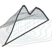
An application for determining your location relative to a loaded route. Lat,Lon →Station/Offset — Alignment Dynamically displays the distance from the beginning of the route and the offset (left, right of the route) and the elevation - A points record is available (with a description) The application determines which Line segment of the route you are on; how much you have traveled; how much more you have to move to the end of the route; at what distance from the route; you are and at what depth ((elevation Slope distance (at what depth) This data will be useful for compiling a Defect list (roads, underground utilities (power line)), for a tourist to maintain a route, and even for an airplane passenger to control movement along the route; Detect Underground Utilities and its depth (Slope distance) - for all this, it is enough to upload a detailed route to the application in the format KML (KMZ, GPX, DXF) {*1} The application, at the touch of a button (Add Label), writes a description of the point with an offset and a picket line relative to the loaded route to the TXT file. https://play.google.com/store/apps/dev?id=5676012283312829659 Station Offset Elevation Description Lat Lon Time 2092.76,3.96,165.00,El-Panel-Board,52.0719607,23.7287989,Thu May 09 17:17:19 GMT+03:00 2024 In case of an emergency shutdown of the application, the file with the dots is not lost, it is immediately created and supplemented when each point is recorded. The file can be found in the downlands folder. It is possible to switch the display of data in feet (possible only before recording the first point) Starting Station(Specifies the station value that is assigned to the beginning of the first alignment entity created) 2D mode- height-free when importing from a KML file. Alignment runs at ground zero (sea level, Horizontal distance) For Alignment up to 40 km long Lat/Lon(MAX-MIN)∠40 km , the error in picketing increases greatly after 40 km 3D mode - taking into account the height specified in the KML file and for extended routes. The 2500 km long highway consisting of 35,000 points was opened by the application in 6 seconds. Only in this mode is Slope distance display available https://stadiamark.almagest.name/Alignment-Tracking/ ________ Welcome to https://stadiamark.com / for files (mp→KML) for the application StadiaMark.com , the project that distributes for free geographic data of routing OpenStreetMap routing all over the world There are many offline routing services using OpenStreetMap data. One of them is the Gpsmapedit: The GPSMapEdit Portable program allows you to export a route to an KML file as a alignment for the Route Alignment Definition application Download Alignment Tracking and make your journeys simpler and more convenient! https://play.google.com/store/apps/dev?id=5676012283312829659
Download
0 formatsNo download links available.