🌍 In this GIS lab tutorial, you'll learn how to perform Land Use Land Cover (LULC) mapping and detect changes over time using satellite data in ArcMap.
We walk through the entire process of supervised image classification using Landsat 8 imagery, including band composition, training sample creation, classification, and area calculation of land cover types like mangroves, water bodies, and barren land.
📌 Key Topics Covered:
Composite Bands (Landsat 8)
RGB Band Combinations
Creating Training Samples
Image Classification Toolbar
Extract by Mask Tool
Raster to Polygon Conversion
Area Calculation using Dissolve Tool
🎯 Objective:
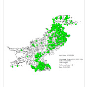
To detect and map LULC changes such as urbanization, forestation, and agricultural spread between 2013 and 2025.
📁 Software Used: ArcMap 10.x
🛰️ Data Used: Landsat 8 Bands (1–7)
🔔 Don’t forget to like, share, and subscribe to Ahmed's Backpack 🛍️ for more GIS and Remote Sensing tutorials!
#GIS #RemoteSensing #LULC #ArcMap #ImageClassification #ChangeDetection
Download
0 formats
No download links available.
Land Use Land Cover Mapping & Change Detection using ArcMap | Supervised Classification Tutorial | NatokHD